In the technological landscape of 2026, the precision of geolocation has reached unprecedented qualitative levels, making it indispensable to know how to put coordinates on Google Maps to move with extreme safety. Whether you are an experienced hiker who explores remote paths or a professional who must indicate an exact point of a construction site, the ability to manage latitude and longitudinal data is a basic digital competence. Google Maps, the flagship mapping service of “Big G”, continued to evolve, integrating increasingly intelligent systems to interpret different input formats. However, despite artificial intelligence helps in automatic correction, manually inserting data remains the most reliable method to avoid ambiguity. Understanding the logic behind decimal degrees or sessagesimal systems allows you to interact with the map not only as a simple user, but as a conscious navigator. In this updated guide, we will explore every facet of the integration of coordinates, analyzing the specific procedures for each device and the tricks not to commit formatting errors that could lead you to thousands of kilometers from your real destination. Prepare to find out how to turn a string of numbers into a precise point on the global map.
Supported formats for geographic coordinates
Gradi Decimali (DD) format
The Decimali Grade format, commonly abbreviated as DD (Decimal Degrees), today represents the most popular standard in web applications and modern geographic information systems. When you try to understand how to put coordinates on Google Maps quickly, this is undoubtedly the easiest format to type. It is based on a purely numerical structure where latitude and longitude are expressed as decimal numbers. For example, a typical coordinate may appear as 41,8902, 12,4922. In this system, the values north of the equator and east of the Greenwich meridian are positive, while the values south and west are expressed with a less (-) sign in front of the number. The simplicity of this format lies in the absence of special symbols such as degrees or minutes, making smooth typing on any type of keyboard, both physical and virtual.
To use the Decimali Grades correctly, it is essential to pay attention to punctuation. In Italy we are accustomed to using comma as a decimal separator, but in the world of international computer science and specifically on Google Maps, point (.) is the only decimal separator accepted. The comma (,) must be used exclusively to separate the latitude value from that of longitude. A common mistake is to reverse the order of factors: always remember that latitude (the distance from the equator) must be inserted first, followed by longitude (the distance from the fundamental meridian). The accuracy of this format depends on the number of decimal digits used; usually, five or six decimal digits guarantee a accuracy of about one meter, ideal for almost every civil or recreational need in 2026.
Degrees, Minutes and Seconds (DMS)
The Gradi, Minuti and Secondi format (DMS) is the oldest and most traditional system, derived from maritime and astronomical navigation. Although it may seem more complex to type, it is still widely used in nautical, aeronautical and topography maps. An example of coordination in this format is 41°53’24.7′′N 122°29’31.9′′E. Here, latitude and longitude are divided into smaller units: one degree consists of 60 minutes, and one minute consists of 60 seconds. This system requires the use of specific symbols: the circle for degrees (°), the single apex for minutes (‘) and the double apex for seconds (“). Moreover, it is mandatory to specify the cardinal direction using letters N, S, E, W (or O for the west in Italian, although Google Maps prefers the international standard W).
When you decide to use the DMS format, Google Maps offers some flexibility. You can insert the correct symbols for a formal accuracy, but the software is able to correctly interpret even the coordinates inserted with simple spaces between the numbers, provided that the cardinal directions are clearly indicated. This format is particularly useful when you consult historical documents or catalytic maps that have not yet been converted to modern digital systems. The main challenge remains the speed of insertion on mobile devices, where finding the symbols of degrees or seconds often requires you to navigate between the various submenu of the keyboard. However, mastering the DMS format gives you a deep understanding of terrestrial spherical geography, allowing you to communicate positions with professionals from various technical sectors.
How to insert coordinates on smartphones and tablets
Procedure for Android devices in 2026
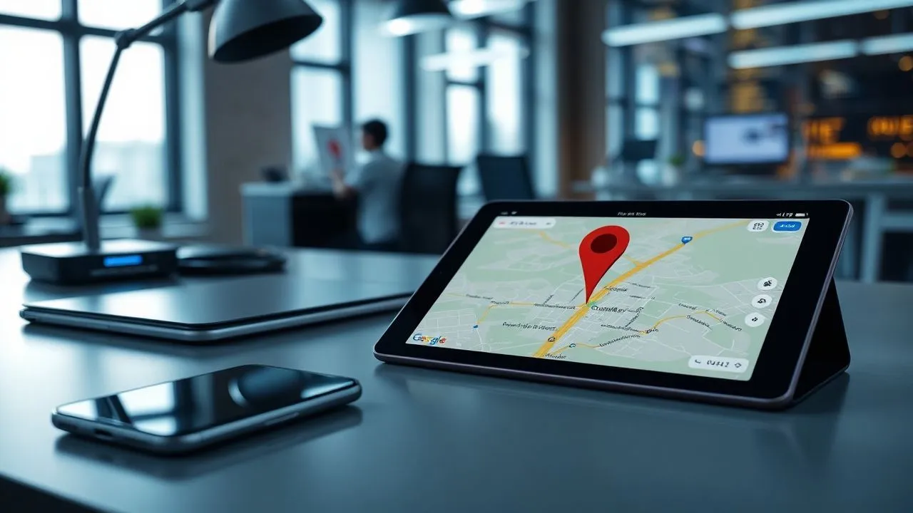
On Android devices, Google Maps integration is total and the procedures for entering GPS coordinates have been optimized to be as intuitive as possible. After opening the official application, the first step is to locate the search bar located at the top of the interface. Instead of writing the name of a street or restaurant, you will need to type the numerical values of your location directly. If you use the decimal grade format, the Android numeric keyboard will allow you to quickly insert the numbers and the point. Once the string is inserted (e.g. 45.4642, 9.1900), just press the magnifying glass icon on the keyboard. The system will instantly process the data, centering the map on the exact point and making a red marker appear that identifies the coordinates provided.
In addition to the simple display, the 2026 version of Google Maps for Android offers advanced tools once the point has been located. By sliding up the information panel that appears below, you can access options such as navigation assisted by augmented reality (Live View), useful if you are in a complex urban center. Also, you can easily save the location in one of your custom lists or share it via instant messaging app. If you have made a small typing error, you do not need to delete everything: you can tap the search bar again and fix only the wrong number. The fluidity of the Android interface makes the operation how to put coordinates on Google Maps extremely fast, ideal for situations where time is a critical factor.
Manage coordinates on iPhone and iPad
The experience on iOS and iPadOS keeps the standards of elegance and simplicity typical of the Apple ecosystem. Also in this case, the operation begins by opening the Google Maps app (free download from the App Store if not already present). A special feature of Apple devices is the inclusion of special symbols for the DMS format. To get the degree symbol (°), you need to hold the zero button (0) long on the virtual keyboard: a small context menu will appear from which you can select the desired symbol. This shortcut is essential for those who prefer formal inclusion than the simplified one. After typing the latitudinal and longitudinal coordinates separated by the comma, pressing the “Cerca” button, the application will move the focus on the corresponding destination.
A significant advantage in using iPad for this operation is the space available on the screen, which allows you to simultaneously view the inserted coordinates and context information of the surrounding area. Once you locate the point, you can use aptic feedback (Haptic Touch) on the placeholder to quickly open a menu of choice. From here, you can start the calculation of the route, view updated Street View images or even measure the exact distance from your current location. The synchronization through the Google account also ensures that each coordinate sought on the tablet is immediately available in the search history of the smartphone, allowing a seamless transition between the planning stage at home and the field moving stage.
Type coordinates from desktop computer
Use of Google Maps web interface
Inserting coordinates from a PC or Mac is the ideal choice for those who need a higher overview or need to manage large volumes of geographical data. Connecting to the official website of Google Maps through any modern browser, you are in front of a multifunctional search bar on the left. Inserting the coordinates here is extremely simple thanks to the use of the physical keyboard, which allows you to type numbers, points and commas with an unbeatable speed compared to the touch devices. After pressing Enter, the system performs a virtual “fly-over” towards the indicated location. This method is particularly appreciated by researchers and event organizers who must carefully verify the correctness of a meeting point before publicly spreading it.
On the computer, visual accuracy has increased from the ability to quickly switch from standard map view to high resolution satellite view. After I realized how to put coordinates on Google Maps from PC, you will notice that the coordinates themselves remain visible or in the left side panel or in the URL of the page in the browser. This allows you to copy and paste data into other documents, spreadsheets or databases with a simple Ctrl+C/Ctrl+V command. In addition, the desktop version facilitates the use of the DMS coordinates thanks to the ease of inserting symbols via keyboard shortcuts (such as Alt+0176 on Windows for the degree symbol), making the process of inputting data less tedious and much more professional.
Shortcuts and integration with the operating system
Working on desktop allows you to take advantage of different integrated features that improve efficiency. For example, you can drag and drop coordinates from a text file directly into the Google Maps search bar in many updated browsers at 2026. Many browser extensions also allow you to highlight a coordinate string on any website and send it directly to Google Maps with a right click. This level of integration transforms the computer into the perfect command center for managing geographies based logistics. We do not forget that, once you enter the coordinate, you can send the location directly to your smartphone associated with the Google account through the “Send to your phone”, saving valuable time.
In addition to insertion, the PC is the best tool for managing the “Plus Codes”, a short and digital version of the geographical coordinates Google has promoted strongly in recent years. These codes work similarly to coordinates but are shorter and easy to remember. If you enter standard coordinates, Google Maps will often show you the respective Plus Code in the information panel. This function is vital for areas where there are no formal civic addresses, such as national parks, rural areas or expanding industrial areas. The ability to navigate between these different spatial identification systems makes the desktop user an expert in managing the modern digital territory.
Golden rules to avoid localization errors
Attention to symbols and punctuation
One of the main obstacles when learning how to put coordinates on Google Maps is the meticulous management of the syntax. Rule number one, as mentioned, concerns the decimal point. Many users make the mistake of using comma as a decimal separator (e.g. 45,123) because they are influenced by local language conventions. However, by Google Maps, the comma only serves to divide the latitude from longitude. If you write “45,123, 9,456”, the algorithm will go in confusion, often returning a search error or, worse, a random point on the map. Make sure that the format is always “XXXX, YY.YYYYY”. Even the order is crucial: first inserting the longitude would lead, for example, a user looking for Rome in the middle of the Indian Ocean.
Another vital aspect is respect for numerical limits. Latitude can vary only between -90 and 90 degrees. Any higher or lower value is mathematically impossible on the Earth's surface. Similarly, longitude must fall within the range between -180 and 180 degrees. If you receive coordinates that exceed these parameters, it is very likely that there is a source error or that the data is expressed in a different reference system, such as the UTM (Universal Transverse Mercator), that Google Maps does not directly support without prior conversion. Always verify the plausibility of the numbers inserted is the first step for a safe and smooth navigation, especially when operating in professional contexts where the error is not allowed.
Reference system verification (Datum)
Although the common user should not worry about it often, it is good to know that Google Maps uses the WGS84 reference system (World Geodetic System 1984). This is the global standard for GPS. If the coordinates you are trying to insert come from old paper maps using different datums (such as ED50 or Rome 40), you may find a dissection of several dozen or hundreds of meters on the digital map. In 2026, most sources provide data already converted to WGS84, but in case of suspicious discrepancies, it is always useful to consult an online coordinate converter. Ensure the consistency of the reference system is what distinguishes an experienced user from a geolocation neophyte.
To ensure maximum reliability, always follow this checklist before pressing:
- Check that the decimal point is a point (.) and not a comma (,).
- Make sure latitude is the first value of the string.
- Check that the values do not exceed the limits of 90 for latitude and 180 for longitude.
- Use letters N, S, E, W correctly or minus signs (-) to the south and west.
- Remove any unnecessary characters such as parentheses or additional text.
Advanced features and complementary tools
Intelligent saving and sharing
Once learned how to put coordinates on Google Maps, a world of possibilities for managing saved positions opens. In 2026, Google upgraded “ Labels”, allowing users to assign custom names to points defined only by coordinates. This is incredibly useful for professionals who need to monitor multiple sites of interest without civic address. You can create a list called “Cantiere Project A” and add all the necessary GPS points. These lists can then be shared with colleagues or friends, who will receive a notification on their device with all ready-to-go bookings. Sharing is no longer only through textual links, but can be integrated directly into calendars or corporate management systems.
Distance measurement is another function that takes enormous advantage of the precise insertion of coordinates. After placing the first placeholder via coordinates, you can right-click (on PC) or hold (on smartphone) and select “Missure Distance”. You can then enter a second pair of coordinates and instantly get the inline air distance between the two points. This function is essential to plan drone paths, antenna installations or simply to evaluate the extension of an agricultural land. The millimeter accuracy guaranteed by GPS data makes Google Maps a technical tool to all effects, accessible to anyone who knows how to correctly manage numbers.
Integration with third-party apps and conversion
Despite the power of Google Maps, there are situations where the coordinates at our disposal are not in a compatible format. For example, topographers often use the UTM format, which divides the earth into zones and provides coordinates in meters. To enter this data on Google Maps, you must use a conversion app or a specialized web service. Fortunately, in 2026 many of these tools are integrated directly into the browsers. Once you convert the UTM coordinates into decimal degrees, the insert follows the standard rules described in this guide. There are also specific trekking applications that export GPX or KML files, which can be imported into Google’s “My Maps” to view entire routes based on a series of chained coordinates.
The opportunities offered by the digital ecosystem also include:
- Amount of complex datasets via CSV files containing latitude columns and longitude.
- Using APIs for developers that automate the inclusion of coordinates from external software.
- Integration with wearable devices as smartwatch recording coordinates in real time.
- Synchronization with satellite navigation systems for latest generation cars.
Frequently asked questions
What happens if I reverse latitude and longitude on Google Maps?
If you accidentally reverse latitude and longitude, Google Maps will still try to locate the point, but the results will be completely wrong. For example, if instead of entering the coordinates of a European city first enter the longitude, you may find yourself in the middle of an ocean or in a different continent. It is a very common mistake that often leads to believe that the app does not work properly. Always remember the reverse alphabet order to help you: Latitude (L-a) comes before Longitude (L-o) in most data entry conventions, or think of latitude as height on map and longitude as at horizontal position.
Why can't I find the rank symbol on the phone keyboard?
Sulle tastiere virtuali moderne, i simboli speciali sono spesso nascosti per risparmiare spazio. Su Android, solitamente si trova nel menu dei simboli secondari (premendo ?123 e poi =<). Su iOS (iPhone), la procedura è più elegante: basta tenere premuto il tasto dello zero (0) e apparirà il cerchietto del grado. Tuttavia, se trovi questa operazione troppo lenta, ricorda che Google Maps nel 2026 è in grado di comprendere le coordinate sessagesimali anche se inserite con dei semplici spazi al posto dei simboli (es. 41 53 24 N 12 29 31 E), rendendo la ricerca molto più rapida e meno frustrante per l’utente.
Does Google Maps support UTM coordinates or other cartographic systems?
No, natively Google Maps does not support the UTM coordinate system (Universal Transverse Mercator) or other local systems such as the Italian disaster system. It only supports grade-based systems (DD, DMM, DMS) related to the WGS84 datum. If you need to enter UTM coordinates, you must first use an online converter or a dedicated application to transform them into Decimali Grades. Once you get the DD values, you can simply copy them and paste them into the Maps search bar to view the desired point with the accuracy you need for your work or activity.
Can I insert coordinates to find a point without internet connection?
The inclusion of the coordinates usually requires an active internet connection so that Google Maps can download the map data and satellite images of the searched area. However, if you have previously downloaded offline maps of the specific area, you can type coordinates and Maps will be able to place the location marker on the map stored in your device. It is a life-saving function for those who practice hiking in areas with poor cellular coverage. Always make sure you plan ahead of time by downloading offline areas if you expect to look for points via GPS coordinates in remote locations or abroad without roaming data.
How many decimals do I have to insert to have a precision of one meter?
To achieve a accuracy of about 1.1 meters to the equator (and even greater as you move towards the poles), you must enter at least five decimal digits after the point in the Gradi Decimali format. If you insert only two decimals, the accuracy drops to about one kilometer, which is useless to locate a specific point. If you insert six, the accuracy reaches about 11 cm, ideal for technical purposes. For most everyday uses, how to share a meeting point or find the entrance of a path, use 5 or 6 decimals is the optimal choice to ensure that the placeholder falls exactly where you want.
In conclusion, master the technique on how to put coordinates on Google Maps represents a remarkable competitive advantage in the digital world of 2026. Whether you choose the decimal format for its speed or sexidal format for its traditional accuracy, the key to success lies in attention to detail and correct formatting. Remember to always use the point as a decimal separator, to respect the latitude-longitude order and to verify the geographical plausibility of the results obtained. Thanks to this guide, you now have all the tools you need to navigate the globe with a millimeter precision, share exact positions with anyone and make the most of the potential of Google's modern cartography. You just have to practice how much I learned: open Maps, enter your first coordinates and start exploring the world from a completely new perspective. Good navigation and good discoveries!


