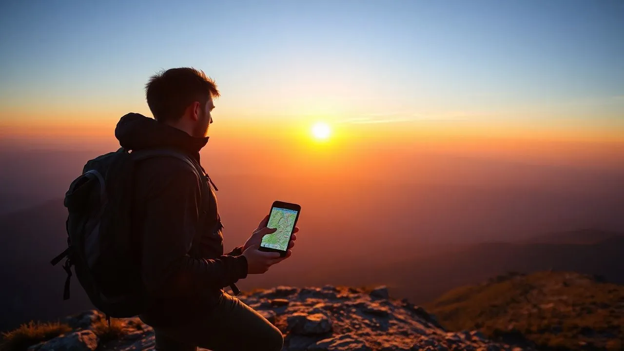
In the technological landscape 2026, the passion for outdoors and hiking has found a fundamental ally in mobile devices. Choose the best hiking apps it is no longer just a matter of comfort, but it is an essential element for security, strategic planning and sharing your adventures. Whether you're an experienced trekker challenging the alpine peaks or a simple lover eager to explore the local paths during the weekend, having precise tools for geolocation and digital cartography can radically transform your experience. In recent years, applications have integrated increasingly advanced technologies, such as augmented reality for the identification of peaks, energy saving algorithms optimized for long GPS sessions and global databases powered by millions of users sharing real-time routes. In this comprehensive guide, we will analyze the most reliable software solutions available for Android and iOS, focusing on critical features such as offline navigation, biometric parameter tracking and user interface ease. We will explore different categories, from pure trekking to mountain biking, to booking guided tours, offering you a detailed overview for every specific need in the world of outdoor activities.
Mountain hiking and professional trekking app
Wikiloc: the global community for outdoor lovers
Wikiloc is also confirmed in 2026 as one of the fundamental pillars between mountain hiking applications. Its strength lies in an endless database, constantly fed by a vast community of hikers who upload and document thousands of new routes every day. The application allows you to filter the search according to the difficulty, distance, altitude difference and even type of activity, ensuring each user to find the perfect route for their physical capabilities. One of the most appreciated features is assisted GPS navigation, which guides the user along the chosen path providing sound alerts in case of removal from the predetermined path. This tool is essential to avoid losing in areas where horizontal signage might be lacking or unseen due to adverse weather conditions.
The use of Wikiloc is extremely intuitive: after creating a free account, you can immediately start exploring the maps or register your activity by pressing the start button. During registration, the app constantly monitors the location, calculating average speed, travel time and altitude earned in real time. You can take geolocation photographs directly from the interface, which will be automatically connected to the exact point of the track on the map. Once the excursion is completed, the software offers a detailed summary that can be saved in your private profile or shared with the community. For those who want maximum performance, the Premium version unlocks advanced features such as real-time tracking for family safety and the ability to download unlimited offline maps.
Maps.me and accuracy of offline cartography
For those looking for a lightweight and focused tool offline outdoor navigation, Maps.me represents a choice of excellence. This application is based on OpenStreetMap data, ensuring a millimeter accuracy even in remote areas where cellular data connection is totally absent. The philosophy of Maps.me is focused on simplicity: the user first downloads the map of the region or the country of interest and can then consult all the paths, points of interest and shelters without consuming data traffic. This approach is particularly beneficial for long hikes in wild areas or abroad, where roaming costs may be prohibitive. The app also includes a powerful search engine to quickly find water sources, stop areas or scenic spots along the way.
A relevant technical aspect of Maps.me is its optimization for energy consumption. Compared to other heavier applications, Maps.me manages the device's GPS module intelligently, significantly extending the battery life of the smartphone, a critical factor when you are away from charging sources for several hours. The graphical interface is clean and devoid of distractions, making the map consultation quick even during the walk. In addition to hiking trails, the app supports road and cycling, making it a versatile tool for those travelling 360 degrees. The possibility to add custom bookmarks allows you to plan in detail every step of the journey, creating a custom itinerary that can be changed at any time according to the needs of the moment.
Advanced navigation for mountain bike and MTB excursions
Relive: Turn your bike into 3D stories
In the field of app mountain bike, Relive occupies a special place thanks to its unique ability to transform GPS raw data into immersive narrative video in three dimensions. After completing a MTB excursion, the application processes the track and generates a video showing the route on a 3D topographic map, highlighting the peaks of speed, the most challenging slopes and photos taken during the journey. This visual approach is not only rewarding from an aesthetic point of view, but it also allows to analyze its athletic performance dynamically. Relive integrates perfectly with other external services and sensors, allowing you to import data from smartwatch and cyclocomputer to further enrich the final multimedia content.
Starting a session on Relive is immediate: just select the “Bike Play” task and press the registration button. The application works in the background, constantly monitoring the move and allowing the user to focus solely on driving the vehicle. A very useful function for bikers is the ability to display its position in real time compared to the total altitude difference, helping to manage energies during the longer and tiring climbs. At the end of the activity, the creation of the video takes only a few moments and can be customized with background music and textual comments. The free version already offers ample possibilities, while the premium subscription allows you to export high-definition videos and access more detailed statistics on physical performance.
Komoot: intelligent planning for cycling
Komoot has become over time the reference standard for those who need gPS outdoor tools specific for cycling and MTB. Unlike other apps that just record, Komoot excels in the planning stage. The user can enter the starting and arrival point, and the algorithm will generate an optimized path according to the type of bicycle used (road, gravel or mountain bike). The app provides detailed information on the type of road background, distinguishing between asphalt, gravel or Singletrack technical paths. This level of detail is essential to avoid being in unpleasant situations with a bicycle not suitable for the ground, ensuring a smooth and fun experience for every type of cyclist.
Another strong point of Komoot is its community of “Expert” that suggest the “Highlights”, that is specific points of interest such as panoramic climbs, hidden fountains or mechanical workshops along the way. These tips are verified and commented by other users, creating an extremely reliable information ecosystem. The app supports turn-by-turn voice navigation, allowing the cyclist to keep the smartphone in his pocket or mounted on the handlebar without having to turn away from the road to see the map. The compatibility with Garmin and Wahoo devices makes Komoot a professional tool perfectly integrated into the workflow of those who practice cycling at advanced levels. Thanks to the possibility of using regional offline maps, the app guarantees maximum reliability even in cross-border tours or deep mountain areas.
- Wikiloc: Ideal for discovering new paths and social sharing of routes.
- Komoot: Excellent for granular planning based on road and bike background.
- Relive: The best to create spectacular 3D video memories of their companies.
- Locus Map: Technical software for Android users that require maximum customization.
- Maps.me: The lightest and most reliable solution for the exclusive use of offline maps.
Platforms to book guided tours and tours
GetYourGuide: instant access to global experiences
If the goal is not self-organization but the guided trekking booking, GetYourGuide represents the world's leading platform. The application serves as a marketplace where certified local operators offer guided tours, daily excursions and outdoor activities of all kinds. The main advantage for the user is the safety of relying on industry professionals, with the possibility to read thousands of verified reviews before proceeding to purchase. In 2026, the app further simplified the check-in process, eliminating the need to print paper vouchers and integrating tickets directly into the smartphone wallet. From historic walks in art cities to challenging volcano trekking, GetYourGuide covers a wide range of activities for every budget.
The interface of the app is designed to facilitate the discovery of new adventures based on the geographical location of the user. Once the main screen is opened, the software suggests the most popular activities nearby, allowing you to filter by date, language of the guide and duration of the excursion. Each tour is described meticulously, clearly indicating what is included (equipment, meals, transport) and what not, avoiding last minute surprises. The flexible cancellation policy, often available up to 24 hours before the event, offers an indispensable peace of mind for those travelling and having to deal with the unpredictable weather or transport. Booking is a quick process that requires few taps, supporting all the main modern electronic payment methods.
Civitatis: the alternative to Italian language tours
Civitatis has cut out an important space in the market digital guides for hikers offering a careful selection of activities, with an eye on the quality of the service and the availability of guides in Italian language. This platform is particularly suitable for those who want to explore international destinations without the linguistic barrier, ensuring a total immersion in the culture and nature of the visited place. The Civitatis app stands out for its aesthetic cleanliness and navigation speed, allowing you to find and block an excursion in seconds. In addition to the classic trekking, the platform offers unique experiences such as photo safari, boat tours aimed at the sight of wildlife and food and wine excursions on the paths of the vineyards.
Using Civitatis also means having access to a dedicated customer support, capable of assisting you at any stage, from choosing the business to after-sales management. The application includes interactive maps to reach the tour meeting points, minimizing the risk of delays. Many of the proposed excursions are exclusive to the platform, the result of direct partnerships with the best local agencies. For the most loyal users, Civitatis often offers loyalty programs or discounts on multiple bookings, making it an economic option for those planning traveling with many organized stages. Transparency on prices, which are always final and free of hidden fees, is one of the distinguishing traits that has brought this application to the top of user satisfaction over the years.
Innovative tools for hiking and tourism
Freetour and GuruWalk: the revolution of walking tours
For those who love walking app urban or peri-urban, the concept of “Free Tour” has revolutionized the way to explore cities and their surroundings. Applications such as Freetour and GuruWalk bring in direct contact passionate local guides with small groups of travellers. The operation is simple: the guide proposes a walk, users book free of charge through the app and, at the end of the walk, leave a free tip according to the degree of satisfaction. This model democratizes access to local knowledge and allows you to discover hidden corners that often escape traditional tourist circuits. The excursions range from classic historical tours to thematic walks on street art, local folklore or on the naturalistic paths that lamb the inhabited centers.
The experience offered by these platforms is strongly based on the human and social side. Guides are often young residents, history students or simple enthusiasts who convey a contagious enthusiasm. Through the app, you can see the profile of the guide, its specializations and feedback left by previous participants. This creates a climate of trust and transparency that stimulates participation. During the excursion, the app serves as a reference point for emergency communications or to receive precise information on the meeting point. It is an excellent way to make new friends and get to know people from all over the world, making walking a moment of cultural sharing as well as healthy physical activity.
Couchsurfing and social hiking
Although born as a platform for hospitality, Couchsurfing has become an excellent resource for those seeking app for trekking of spontaneous group. The “Hangouts” section of the application allows users to report their availability for a specific activity, as an excursion on a nearby path. It is frequent to find places that offer to accompany travellers to discover less beaten paths, acting as true friendly and informal guides. This type of approach allows you to live the mountain or the surrounding nature with the eyes of those who live it daily, discovering secrets and curiosities that no paper or digital guide could ever bring back entirely.
Security is guaranteed by a cross-reference system that allows you to verify the reliability of the people with whom you decide to share the journey. Participating in an excursion through Couchsurfing often means closing the day in front of a typical dinner or in a shelter recommended by the “local” in turn, enriching the travel experience of a fundamental anthropological component. The application is free in its basic version, but requires a small contribution to the verification of the profile, thus ensuring a community of users seriously interested in cultural exchange. In 2026, the integration of instant messaging functions and position sharing made it even easier and more immediate to organize outdoor meetings in total safety.
- Select the destination: Use the search bar to find the city or natural area of your interest.
- Filter results: Enter parameters such as language, maximum price or tour duration.
- Read reviews: Check the experience of other users to ensure the quality of the guide.
- Book the place: Get instant confirmation and save your digital ticket on your smartphone.
Topographic maps and offline navigation for hiking
Locus Map: the power of technical data on Android
When we talk about digital topographic maps on Android platform, Locus Map is indisputably the most professional choice. This application is designed for those who are not satisfied with a simple GPS track, but need advanced cartographic analysis tools. Locus Map allows you to import an incredible variety of map formats, including the most complex vector data, and to overlay different information layers, such as level curves, relief shadings and catastalis data. It is the ideal tool for geologists, amateur cartographers and hikers who like to plan their paths outside the beaten paths, studying in advance the orography of the soil with extreme precision.
The app offers integrated “Geocaching” functions, making it popular among lovers of digital treasure hunt. Track management is meticulous: each recording can be divided into segments, analyzed by average slope and compared to previous performance. A key aspect of Locus Map is its ability to interface with external sensors via Bluetooth or ANT+, such as cardiofrequency sensors or cadence sensors, turning the smartphone into a real onboard computer for outdoors. Although the interface is initially complex for a neophyte, the learning curve is largely repaid by the depth of available functions, which allow a total customization of every aspect of navigation and tracking.
3D Maps: the three-dimensionality at the service of iPhone and iPad
For Apple users, 3D Maps is one of best hiking apps thanks to its exceptional graphics of mountain reliefs. The application uses high-resolution data to generate realistic three-dimensional maps, which allow the hiker to immediately display the physical commitment required by a given path. Seeing the silhouette of a 3D mountain on the display of the smartphone greatly helps spatial orientation, making it easier to identify surrounding peaks, valleys and ridges. The app allows you to download large portions of territory for offline use, including both road maps and detailed maps with officially marked trails.
Maps 3D integrates a precision altimeter that uses both GPS data and the barometric sensor of the device (where present), providing accurate readings of the quota even under poor satellite coverage. The planning function of the routes is intuitive: just “sign” with your finger on the 3D map to immediately get a altimetric profile of the route and an estimate of the travel times. This tool is particularly useful during the preparation phase at home, allowing you to evaluate different variations of an itinerary before you actually undertake it. The smoothness of navigation and sharpness of the maps make Maps 3D a pleasant application to use and very effective in conveying the feeling of depth of the mountain landscape.
The best tool for modern hikers is not the one with more functions, but the one that disappears on the way, offering security and guidance without ever becoming an obstacle to contemplation of nature.
Tips for secure planning of outdoor routes
Battery management and energy optimization
The mountain safety inevitably passes through proper management of their technological tools. Using intensive GPS applications can quickly download the battery of the smartphone, leaving us isolated when needed. To overcome this problem, it is essential to adopt some precautionary strategies. First of all, it is advisable to always download the maps offline before leaving, so you can activate the air mode during the excursion. This prevents the smartphone from wasting energy constantly looking for the cell signal in areas where coverage is absent. In addition, it is good to reduce the brightness of the screen and close the unused applications that work in the background, preserving precious milliampere-hour for emergencies.
Another strategic advice is to always bring a power bank of adequate capacity, ensuring that it is loaded and equipped with the necessary cables. In 2026, many technical backpacks integrate flexible solar panels that can provide a slow but constant charging during the journey, an excellent option for multi-day trekking. It is also useful to configure the hiking apps to record the location at regular intervals (e.g. every 30 or 60 seconds) instead of continuously, drastically reducing the workload of the processor and GPS module. Remember that technology is a support, but having a paper map reserve and a compass remains a golden rule for each responsible hiker who respects.
Location sharing and emergency systems
In the event of injury or loss, the rapidity of aid is determined by the accuracy with which its position is communicated. Many modern mountain hiking applications integrate “Live Tracking” functions that allow trusted contacts to monitor our movements in real time via a secure web link. If this function requires a minimum data connection, there are also SMS-based systems that automatically send GPS coordinates at preset intervals. It is essential to educate friends or relatives on how to interpret these data and on what maximum return times are planned, as well as to trigger the alarm with the competent authorities.
In addition to navigation apps, it is highly recommended to install the official applications of national alpine rescue services, which allow you to make emergency calls simultaneously forwarding the exact geographical position to the operating station. These tools have saved countless lives in recent years, drastically reducing the time of localization of missing persons. Before taking a solo tour, always check that the localization service is active and that the app has the necessary permits to access GPS data even on a blocked screen. The technological preparation, combined with a solid knowledge of the territory and a correct evaluation of its physical conditions, is the basis for a serene outdoor activity and without any risk.
- Full charge: Make sure your smartphone and power bank are 100% before departure.
- Offline maps: Check that the area of the excursion has been downloaded correctly for use without data.
- Emergency contacts: Configure quick rescue numbers and share your itinerary with someone at home.
- Weather updates: Check the local forecasts for the share you want to achieve.
Frequently asked questions about hiking apps
What are the best free hiking apps?
There are numerous excellent options that do not require compulsory payment for basic functions. Wikiloc and Komoot already offer a lot in their free version, allowing you to search for routes and register your activities. Maps.me is completely free to use offline maps, based on the community’s open data. Often the limitations concern advanced features such as real-time tracking or access to very specific proprietary topographic maps, but for standard use free versions are more than sufficient.
Do trekking apps work without the internet?
Yes, provided the user has previously downloaded the maps of the area concerned. Once you have saved your cartographic data in your smartphone's memory, the integrated GPS module will continue to function regularly even in the absence of telephone signal or 4G/5G data connection. This is the key feature that distinguishes a good hiking app from a simple road map app: the ability to operate independently in remote and hostile environments, always ensuring orientation.
Is it possible to import GPX files in these applications?
Of course. Most professional apps like Locus Map, Komoot or Wikiloc allow you to import files in GPX or KML format. This is extremely useful if you downloaded a route from a specialized website, from a travel blog or if a friend sent you the route of his last excursion. Once the file is imported, the app will show it on the map and you can use it as a guide for your navigation, following the line drawn with maximum precision.
How accurate are the app altitude data?
The accuracy of altitude depends on several factors: the quality of the GPS sensor of the smartphone, the presence of an internal barometric sensor and the density of the altimeter data of the map used. In general, modern apps offer a good approximation, with scraps that usually do not exceed 10-20 meters. For greater accuracy, applications such as 3D Maps use very detailed digital soil patterns (DEM) that correlate the GPS signal error by crossing it with the geographical coordinates known on the topographic map.
Do hiking apps consume a lot of battery?
The use of GPS is one of the most energetic activities for a smartphone. The continuous registration of the route and frequent consultation of the map with the screen on can exhaust the charge in a few hours. However, by activating air mode, reducing the GPS sampling rate and using offline maps, you can greatly extend the duration. It is always advisable to have an external power bank for excursions that exceed the 4-5 hours of duration, especially if the smartphone is the only available navigation tool.
In conclusion, the best hiking apps today they represent an irreplaceable travel companion for anyone who wants to live nature in a conscious and safe way. From Locus Map's technical precision to Relive's visual show, through GetYourGuide's booking convenience, the options available in 2026 are varied and able to meet each user profile. However, it is good to remember that technology must always be accompanied by good sense and proper physical preparation. Now that you have all the information you need to choose the most suitable tool for your needs, you just need to download your favorite app, plan your next itinerary and start discovering the wonderful trails that await you. Good excursion and remember to always respect the environment that hosts you!


